Difference between revisions of "Anse Aux Pins"
From Seychelles
Beachmaster (talk | contribs) |
Beachmaster (talk | contribs) |
||
| Line 3: | Line 3: | ||
{| class="imageTable" | {| class="imageTable" | ||
|- | |- | ||
| − | |colspan="3" | [[File:Anse Aux Pins Mahe | + | |colspan="3" | [[File:Anse Aux Pins Mahe 003.jpg|600px]] |
|- | |- | ||
|[[File:Anse Aux Pins Mahe 002.jpg|196px]] | |[[File:Anse Aux Pins Mahe 002.jpg|196px]] | ||
| − | |align="center"|[[File:Anse Aux Pins Mahe | + | |align="center"|[[File:Anse Aux Pins Mahe 001.jpg|196px]] |
|align="right"|[[File:Anse Aux Pins Mahe 004.jpg|196px]] | |align="right"|[[File:Anse Aux Pins Mahe 004.jpg|196px]] | ||
|} | |} | ||
Latest revision as of 16:44, 21 April 2011
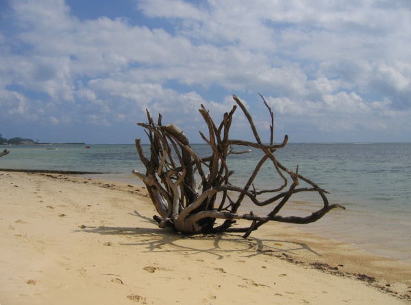
Anse aux Pins has been heavily impacted by human development in the area since the 1970's. Most parts of this beach are narrow and coarse-grained.

| ||

|

|

|
Attempts were made in the 1970's to try protect the shoreline from degredation. Seawalls and groynes were built but gradually after being exposed to the forces of nature most of the structures are disintegrating. There are isolated pockets where the erosion is more prominent but the situation is being monitored closely by environmental groups.
Though not as popular as Anse Royale for picnics the beach is used heavily by the local fishing community as a landing ground. During the southeast moonson from May until October swimming outside the reefline can be dangerous due to strong currents.